Search
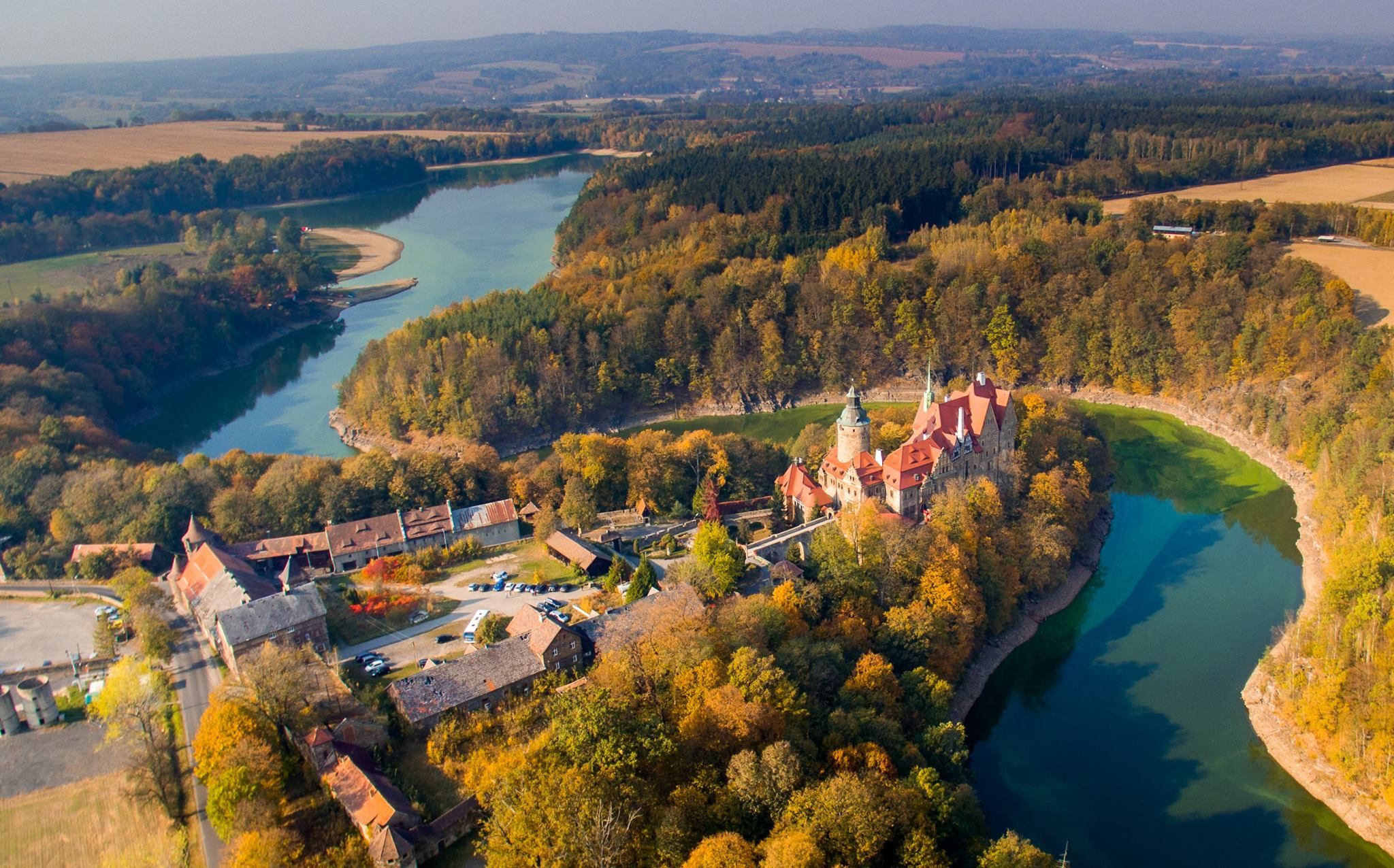
Zamek Czocha nad jeziorem Leśniańskim, fot. Zamek Czocha
"Magic of Water" route
Lower Silesia hides three picturesque rivers in its landscape - the Lusatian Neisse, Kwisa and Beaver. Although they flow inconspicuously among the local attractions, it is water that has shaped the local trails for millennia and has become both a symbol and the area's greatest treasure. Its beauty has always attracted travelers, delighting them with its natural charm. Faced with dangerous floods that once brought destruction and human tragedies, man decided to tame the element while maintaining harmony with nature. As a result, at the beginning of the 20th century, stone dams were built on the Bóbr and Kwisa rivers, creating three picturesque lakes: the Pilchowicka, Zlotnickie and Lesniańskie lakes. It's worth the trip to discover the extraordinary charm of these watery landscapes.
The route is about 85 kilometers. A minimum of 8 hours is required to cover it. In 99% it leads along asphalt roads, and 1% is an optional gravel road (to the Sailing Stop "Izery" on Lake Lesniańskie). From Zgorzelec to Radoniów there are numerous gas stations along the route, where restrooms are also available for those who need additional facilities. From Radoniów to the end of the route at the Pilchowice Dam, the number of such places is very limited.
Zgorzelec
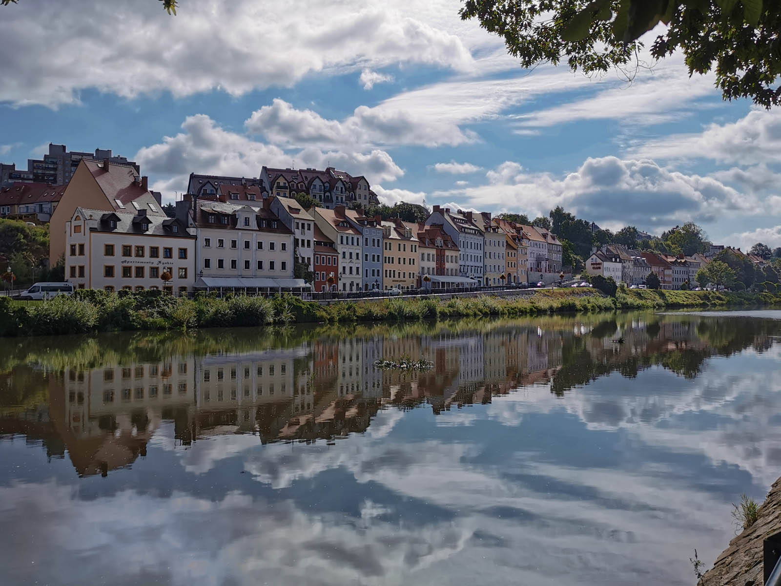
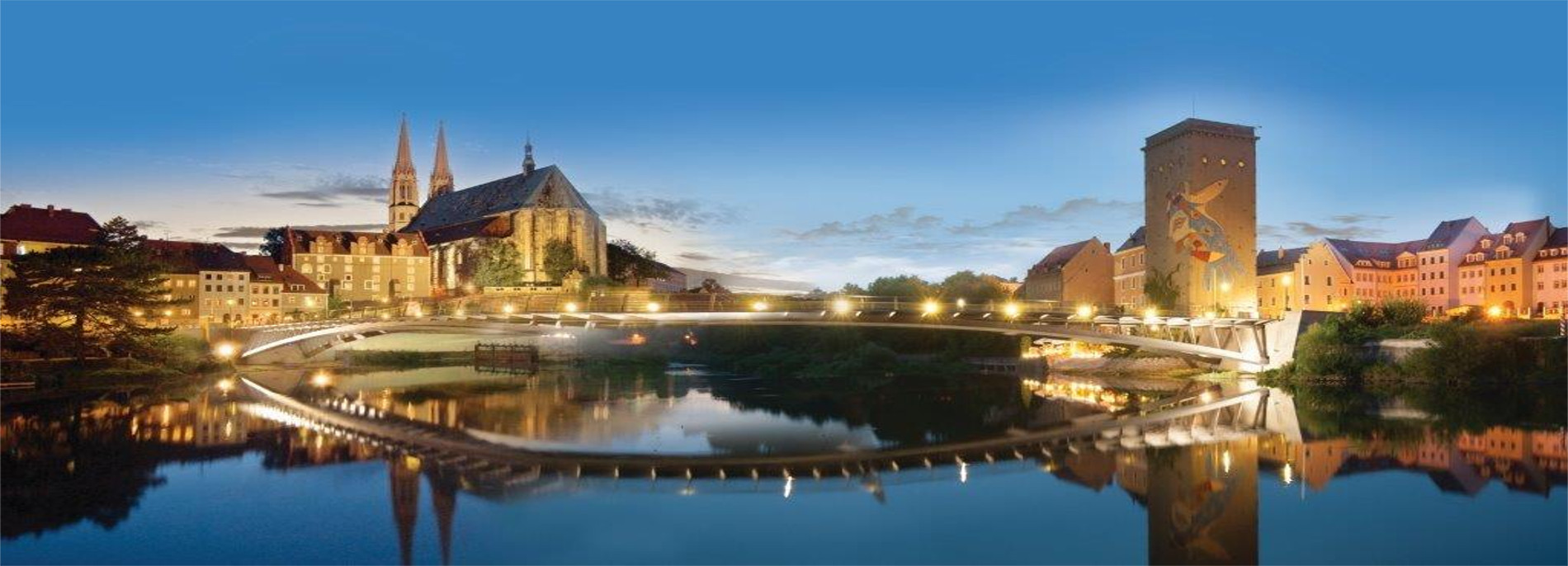
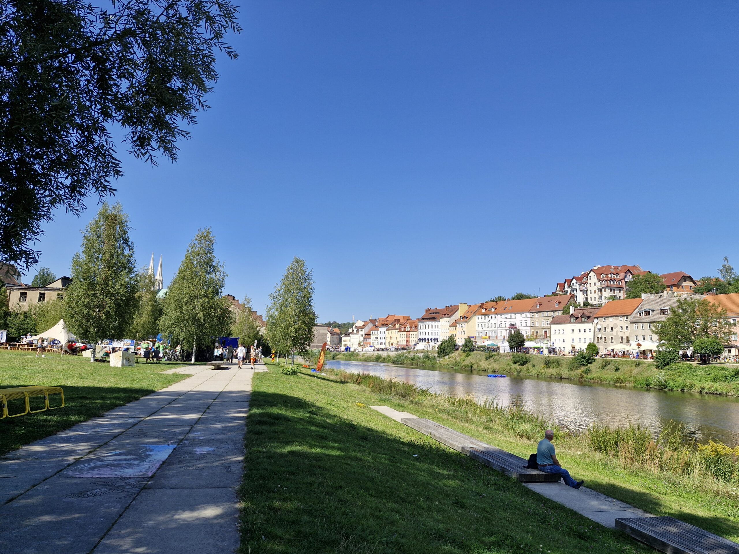
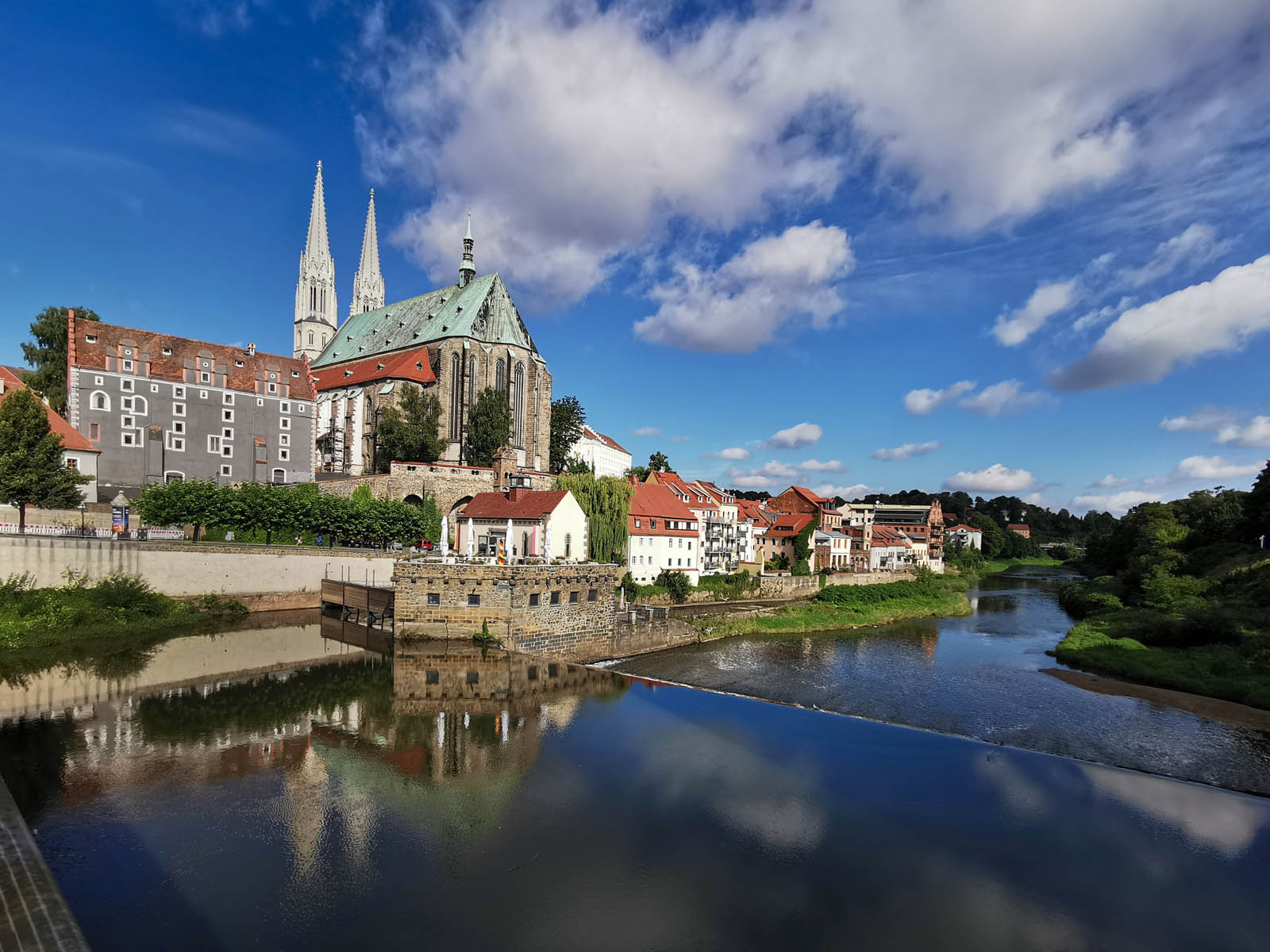
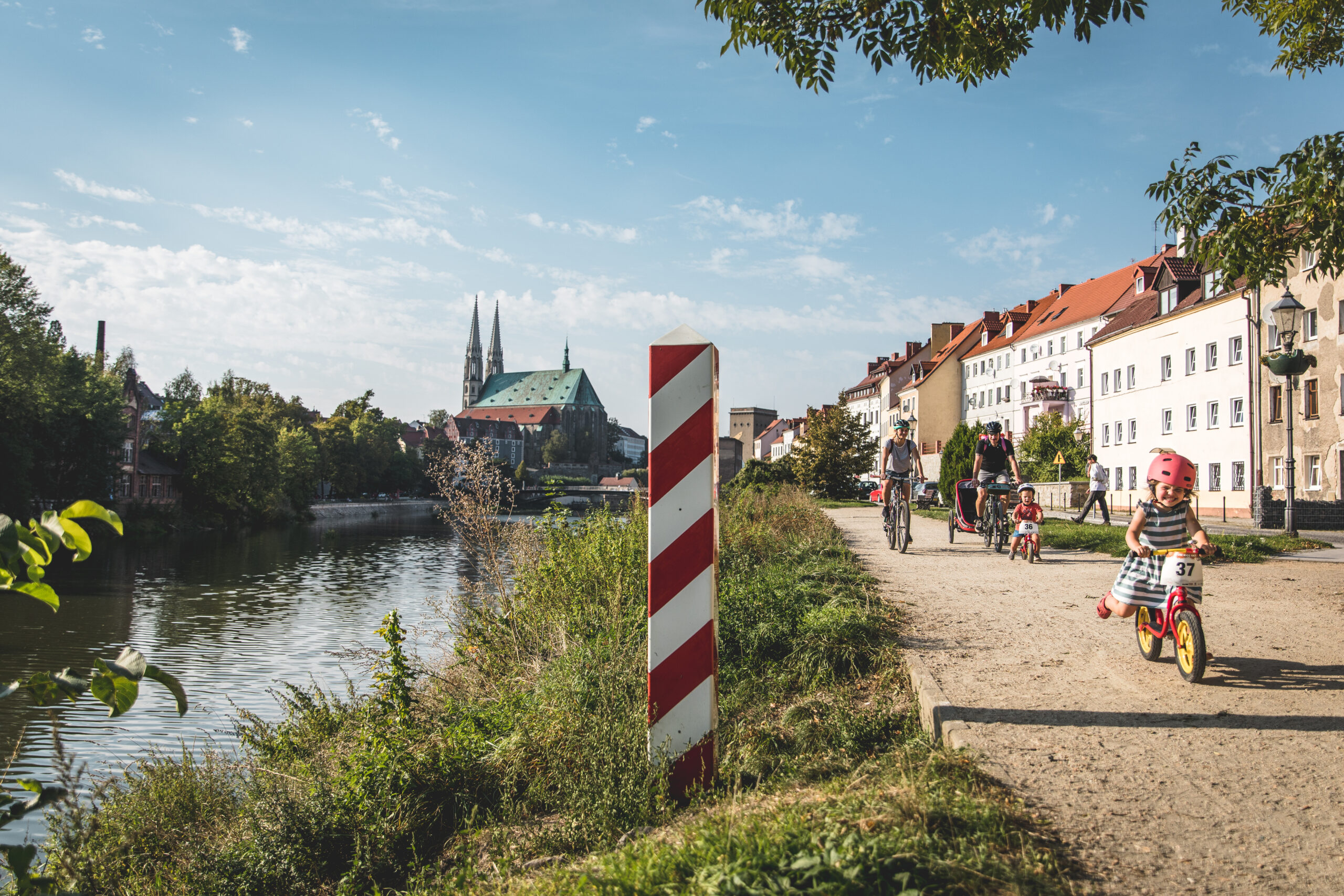
A walk on the Nysa Suburb, a beautiful boulevard of Zgorzelec, is best started at the curve in the northern part of Wroclawska Street. There are plenty of parking spaces here. Starting the tour, you can immediately admire the panorama of the old town from the height of the escarpment over the Lusatian Neisse River, with the dominant body of the 15th century Church of St. Peter and Paul, which is the largest hall church in Saxony. Also noticeable in its shadow is the Waidhaus (Gray House) from the 13th century, which is the oldest secular building in the city. As a result of the new division of the borders after World War II, in 1945, the city was divided into Polish and German parts. The old town found itself on the side of our western neighbors, but crossing the border here is not a major problem. All you have to do is use the Old Town Bridge, which, by being closed to automobile traffic, allows you to safely reach the other side without any problems. In the wide panorama of buildings stretching along the river, you can spot the remnants of a former mill. Note the interesting symbolic bas-relief on its wall, which is titled: "WAZE, or Artistic Image of United Europe." Its authors are two Armenians, Vahan Bego and Michal Bulak. At the level of the bridge, Wroclawska Street turns into Daszyńskiego Street. Along its course one can see beautiful historic tenement houses interspersed with modern buildings that imitate the ancient character. Particularly noteworthy is the house where Jakub Böhme, a German philosopher and mystic, lived. Along the Lusatian Neisse River runs a walking alley, which can be easily reached as far as the John Paul II Bridge. An interesting option is to walk this stretch on the Polish side of the border and return on the German side. Zgorzelec, both in the Polish and German parts, has very interesting architecture and is among the few cities in the region that were only slightly destroyed during World War II. You should set aside a minimum of one hour to visit this place.
Parking spaces for people with disabilities are located along Wroclawska Street. Payment for parking can be made in mobile applications or at a parking meter. The sidewalks and walking alleys are fully paved and have no architectural barriers (high curbs, stairs, etc.). The route along the Lusatian Neisse River, both on the Polish and German sides, partly runs on paving slabs and partly on hard gravel sidewalk. Ascending sidewalks lead to the market in the old town. Some of them are lined with cobblestones, which can cause problems for people in wheelchairs.
Luban
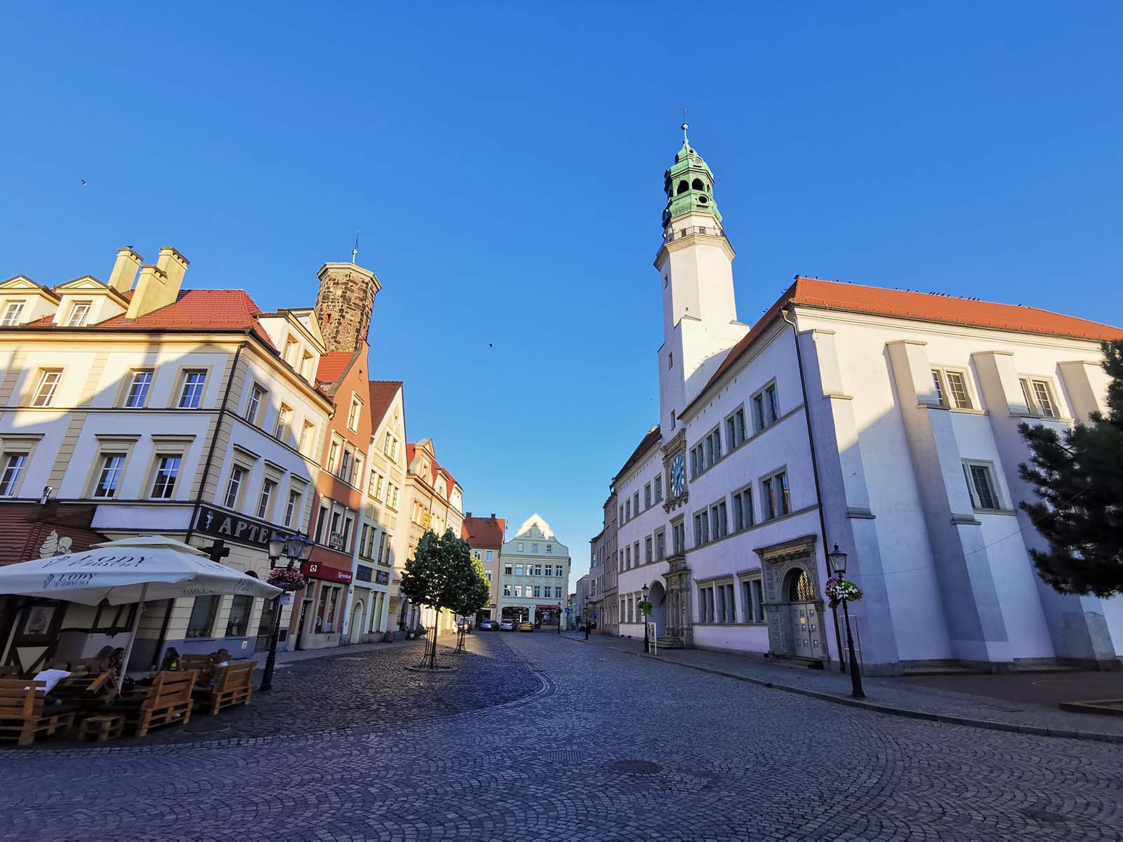
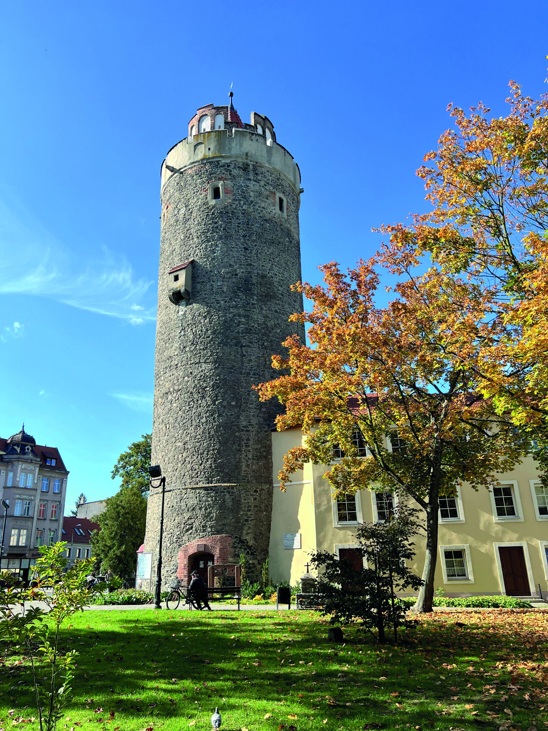
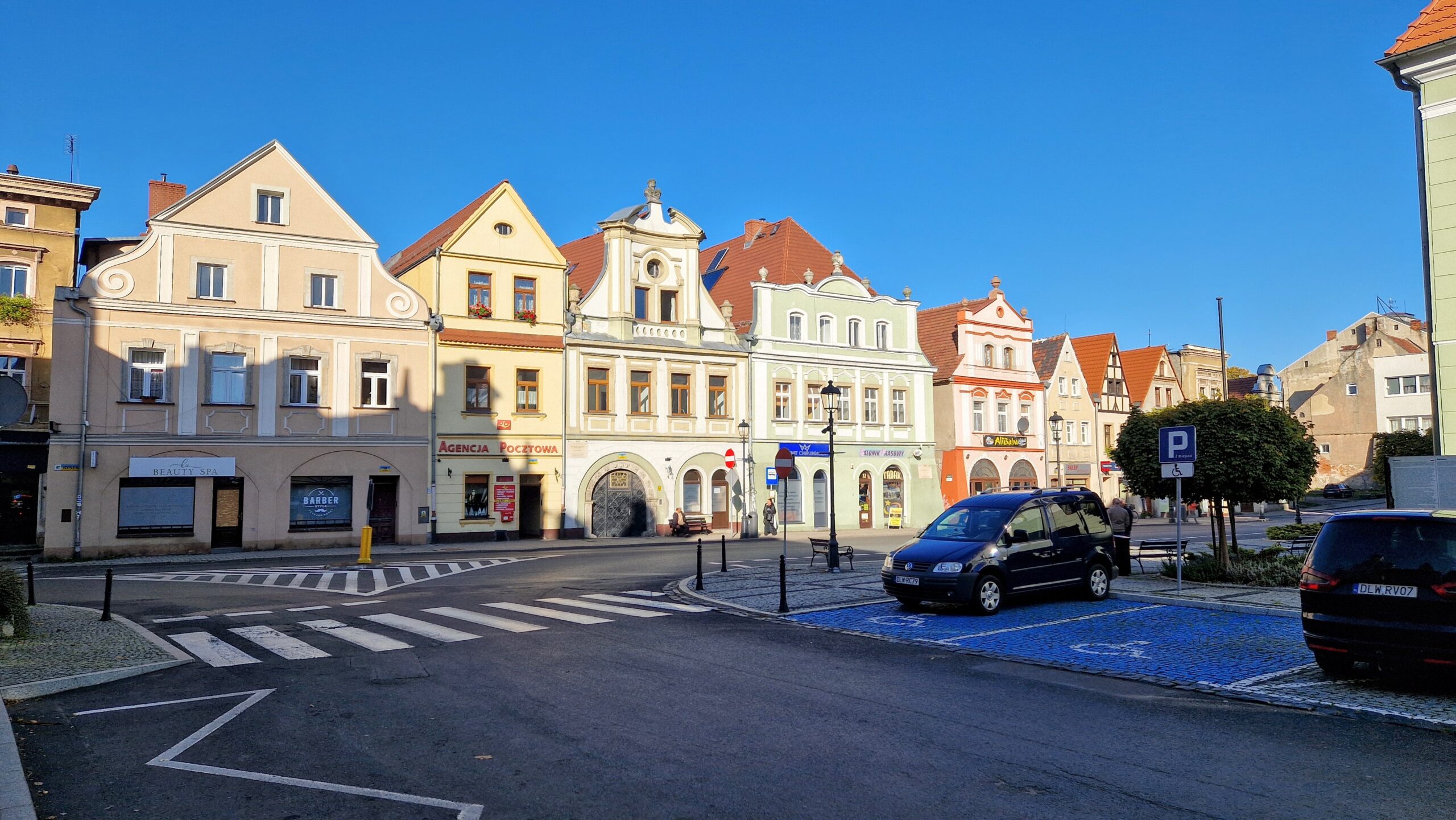
From Zgorzelec, the route leads along Route 30 to Luban. It is a picturesque town on the Kwisa River, which hosted Napoleon Bonaparte twice (in 1807 and 1813). Unfortunately, World War II left a strong imprint on its monuments. The area of the old city is a zone of intermingling of different architectural styles. There are fragments of 14th-century defensive walls, a reconstructed Renaissance town hall building, but also angular concrete blocks dating back to the post-war years. The beautiful Brock Tower and the historic Salt House are noteworthy, but their surroundings should be looked at with a pinch of salt, as they are not very interesting.
In the market square, as well as in the numerous streets leading away from it, you can find quite a few parking spaces with an envelope. The parking fee (on weekdays) must be paid at a parking meter. The perimeter of the market has various surfaces - from smooth paving slabs to uneven cobblestones. Finding the most convenient way to drive can be slightly challenging. Cooperative Street, leading from the town hall to the Friar's Tower, is closed to traffic.
Forest
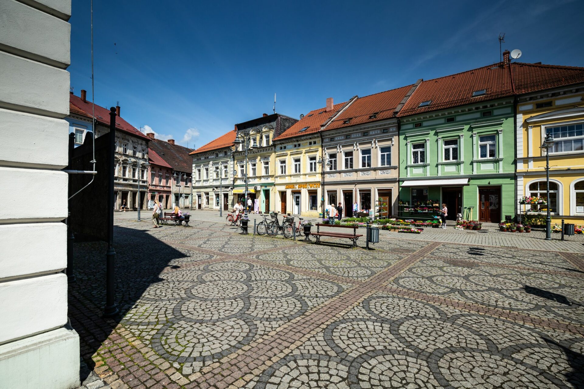
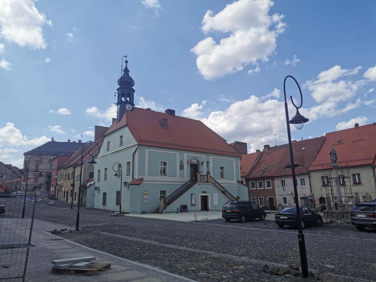
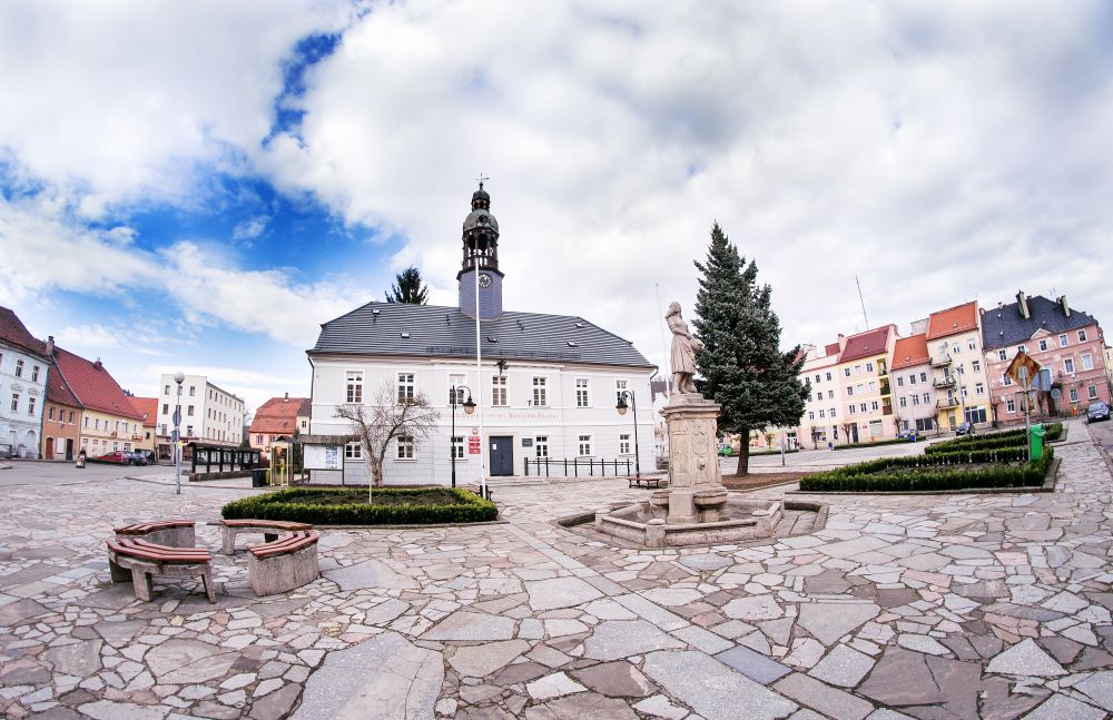
From Luban the scenic road No. 393 takes you to Lesna. An interesting fact is that going along this route, we repeatedly cross the railroad line. The road is laid out in such a way that you have to cross it every now and then, but it runs parallel to the Kwisa River all the time. In Lesna it is best to stop near the town hall, which is tightly surrounded by frontages consisting of 19th-century townhouses. The rather low-rise buildings are an interesting mix of Baroque and Classical styles. The arcaded arcades in the southern part of the market are very impressive.
A parking lot with parking spaces for people with disabilities is located next to City Hall. It is located in the central part of the town square, making most of the sights accessible without having to walk long distances. The surface is small granite pavers, as well as flagstones.
Leśniańska Dam
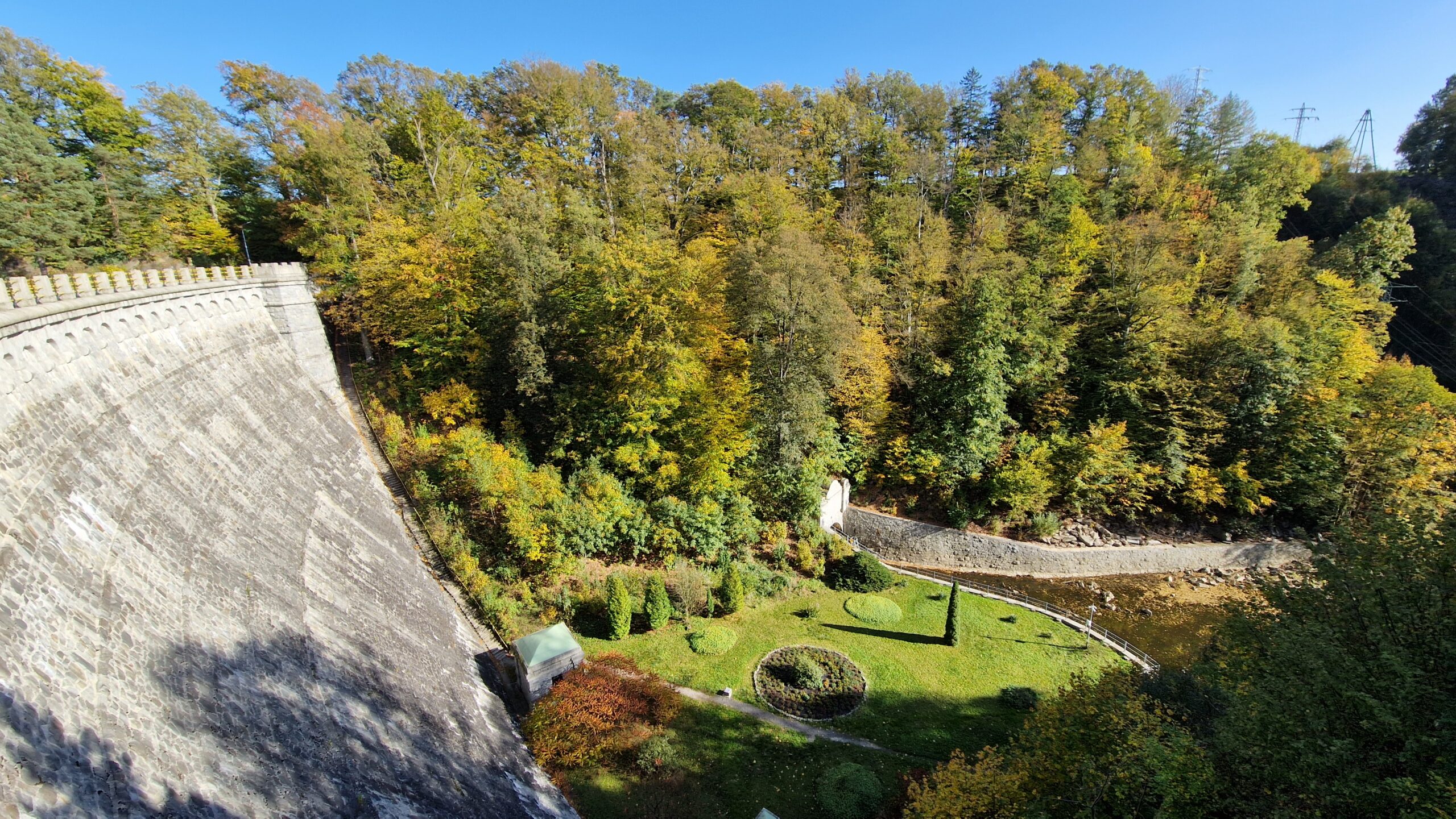
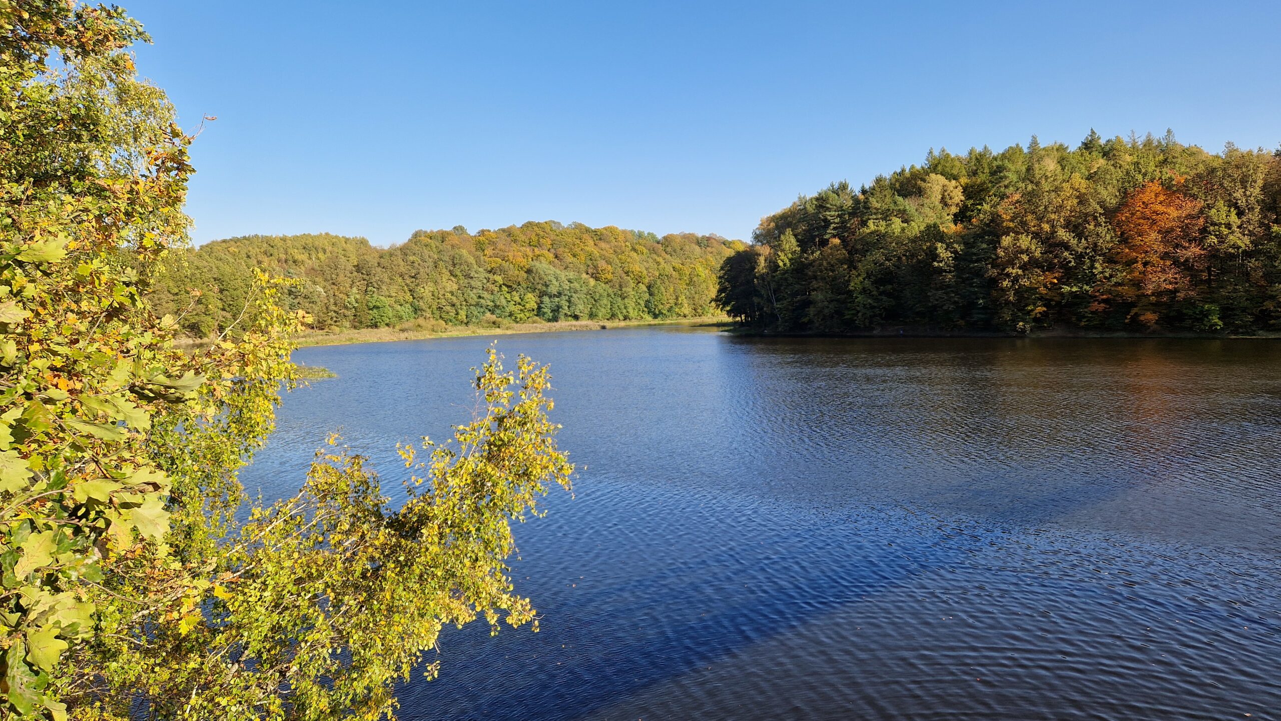
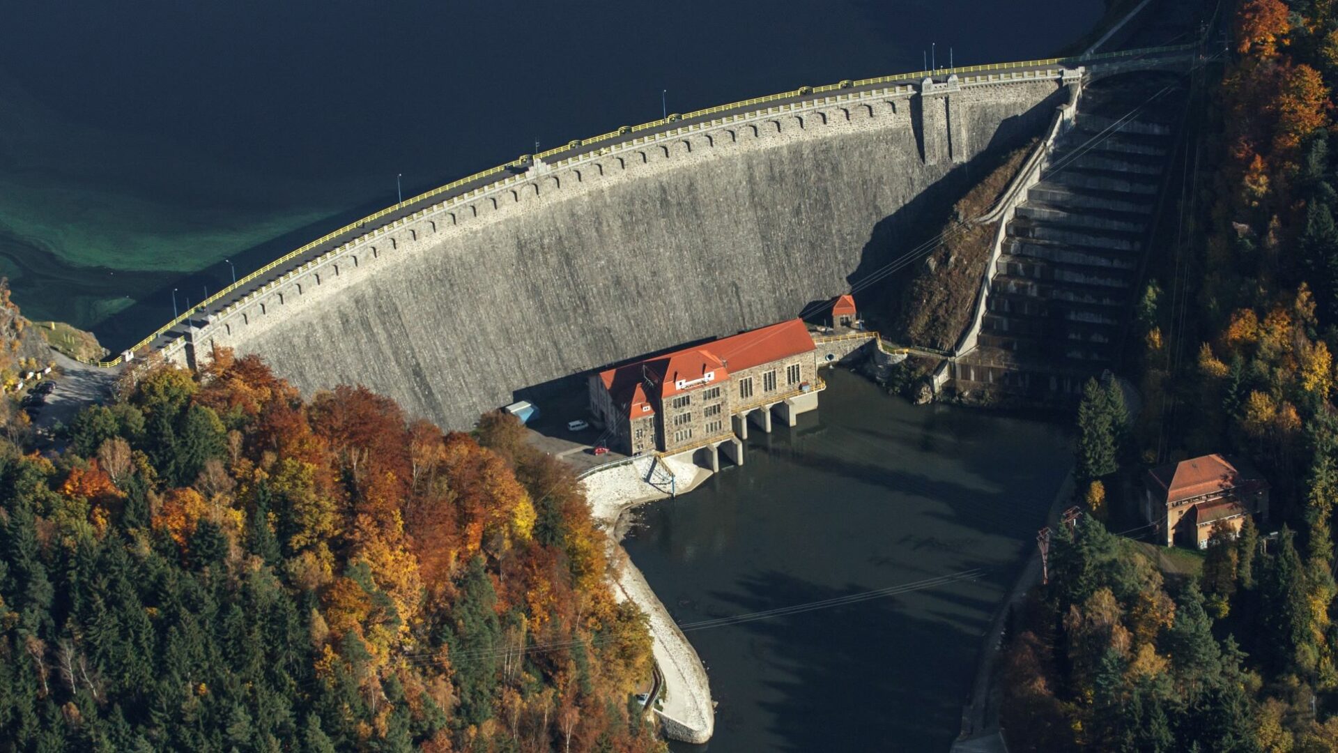
Heading towards Czocha Castle, it is worth turning left from the main road before reaching your destination. At the no-entry sign there is a spacious parking lot, from which the road continues without a car to the crown of the Leśnia Dam. It was built on the Kwisa River after a disastrous flood in 1897, and the construction was completed at an express pace in 1905. On the cornerstone were inscribed the words: "To the valleys for protection, to the waves in spite of them, to all for their good." The dam measures 36 meters high, is 130 meters long at the crown, and 8 meters wide. At the base, its footing is as wide as 38 m. From the crown one can admire the dammed waters of the Kwisa River, which formed Lake Lesniańskie.
The unpaved parking lot is located about 200 meters from the dam. A wide asphalt street leads to it, which is used by vehicles with a special permit, but there is little traffic. On the crown of the dam on the lake side there are metal railings, which do not impede the view. On the other side there is a stone wall that limits the view. A wide and smooth road runs across the crown.
Czocha Castle
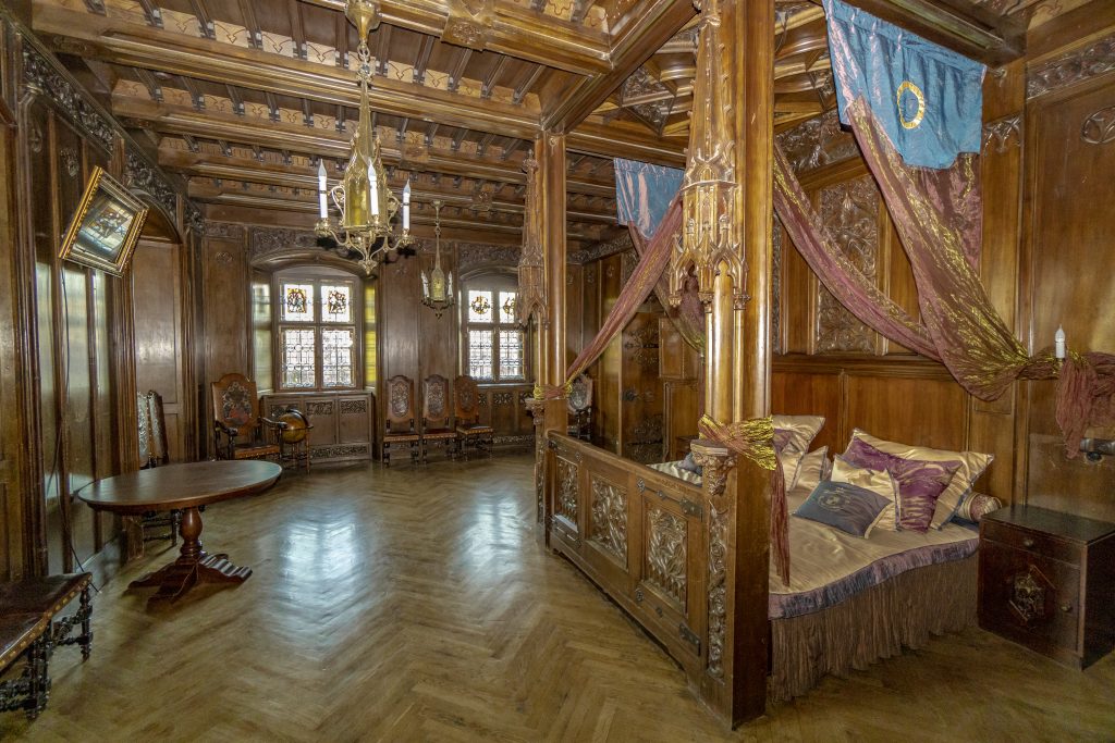
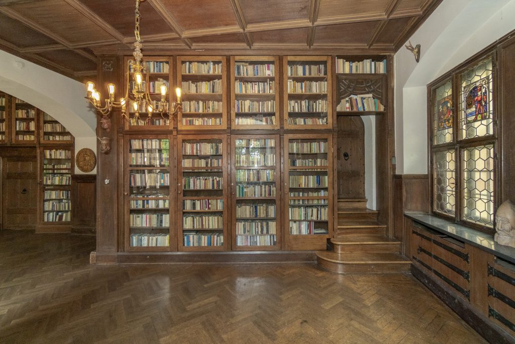
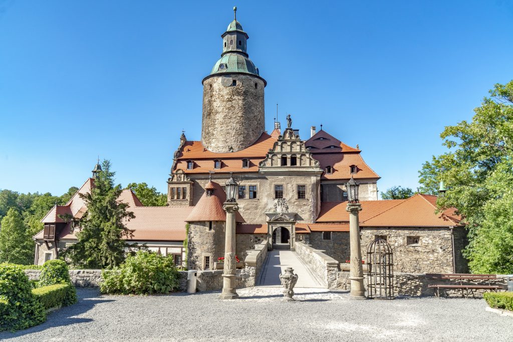
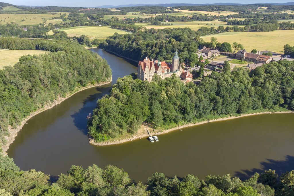
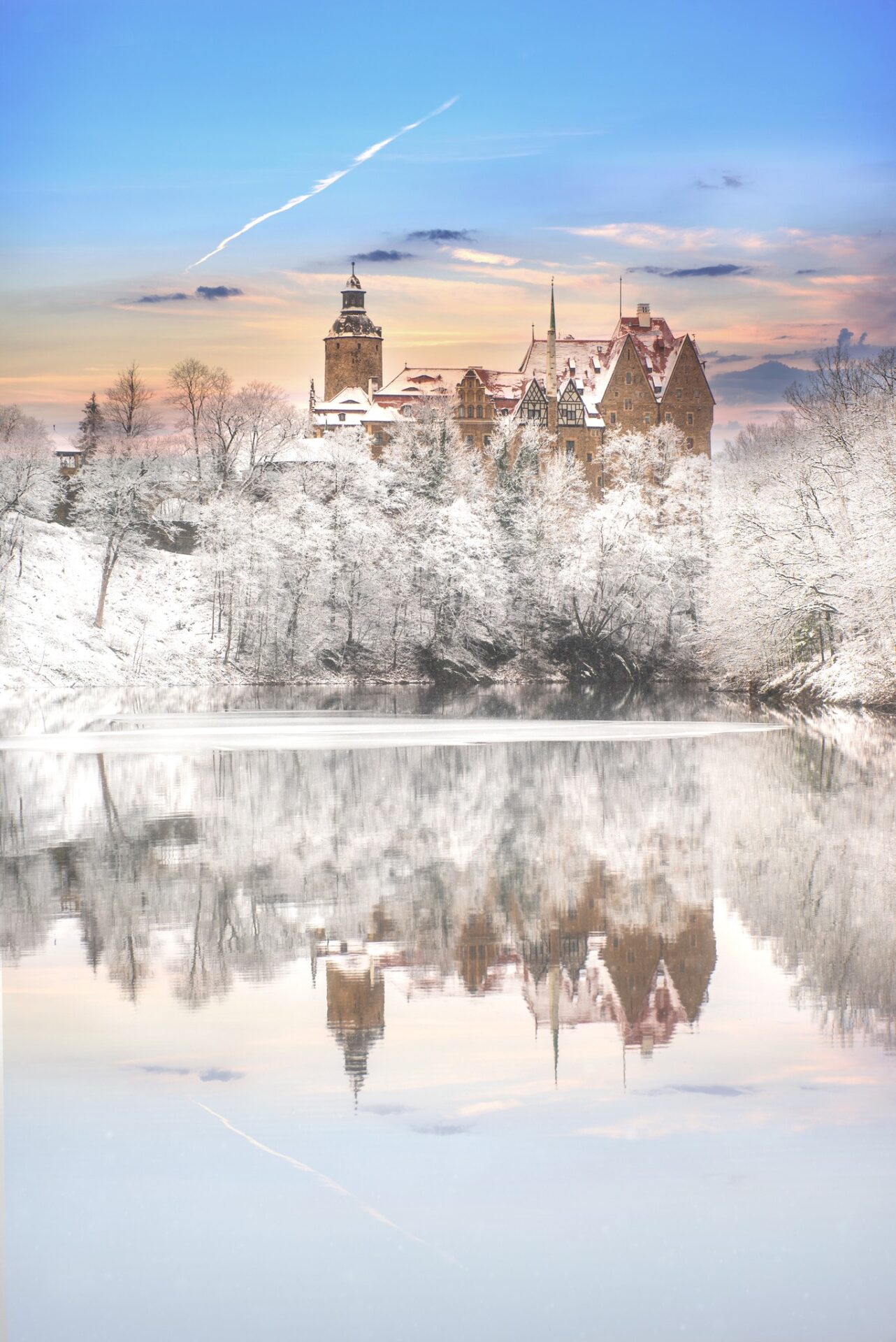
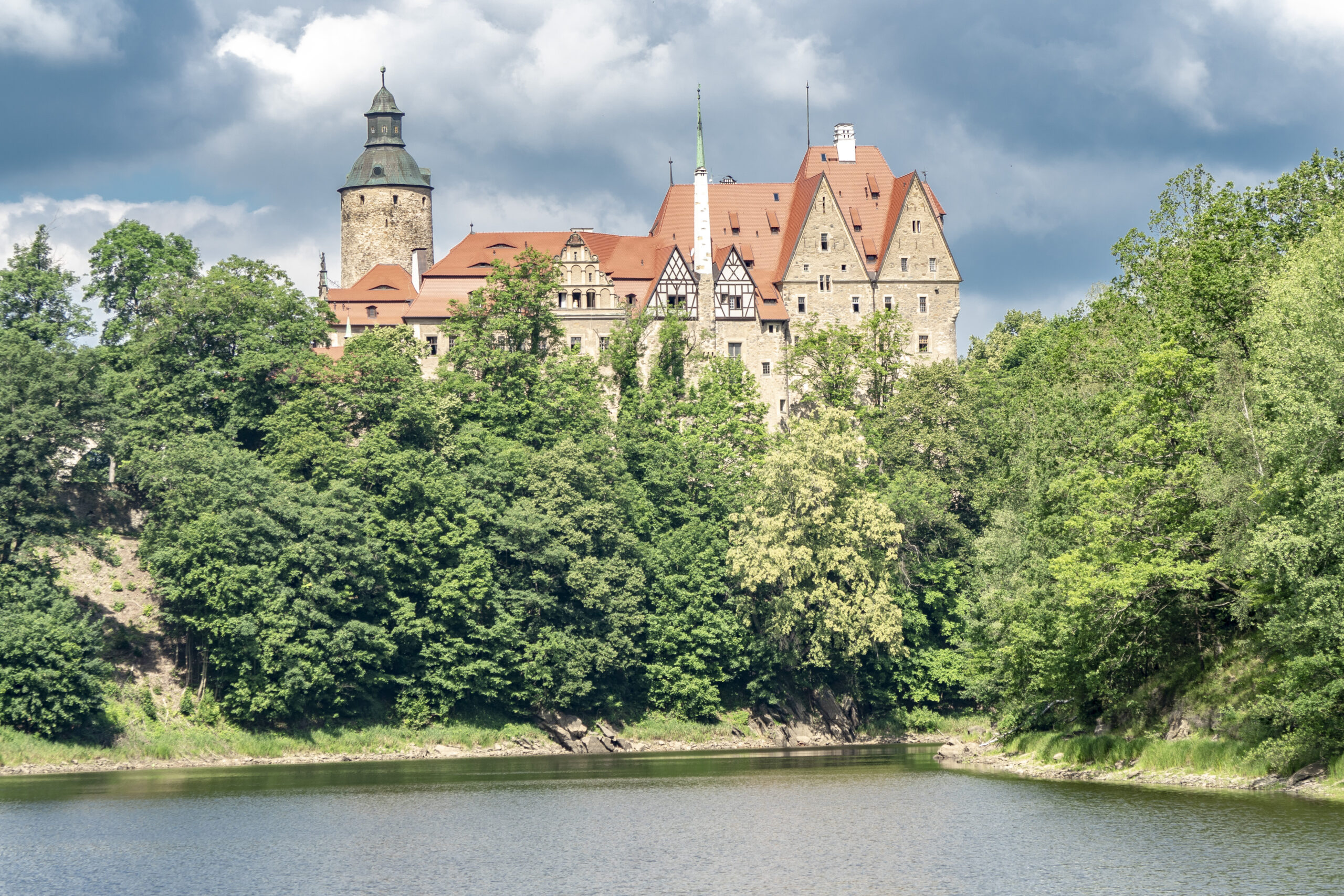
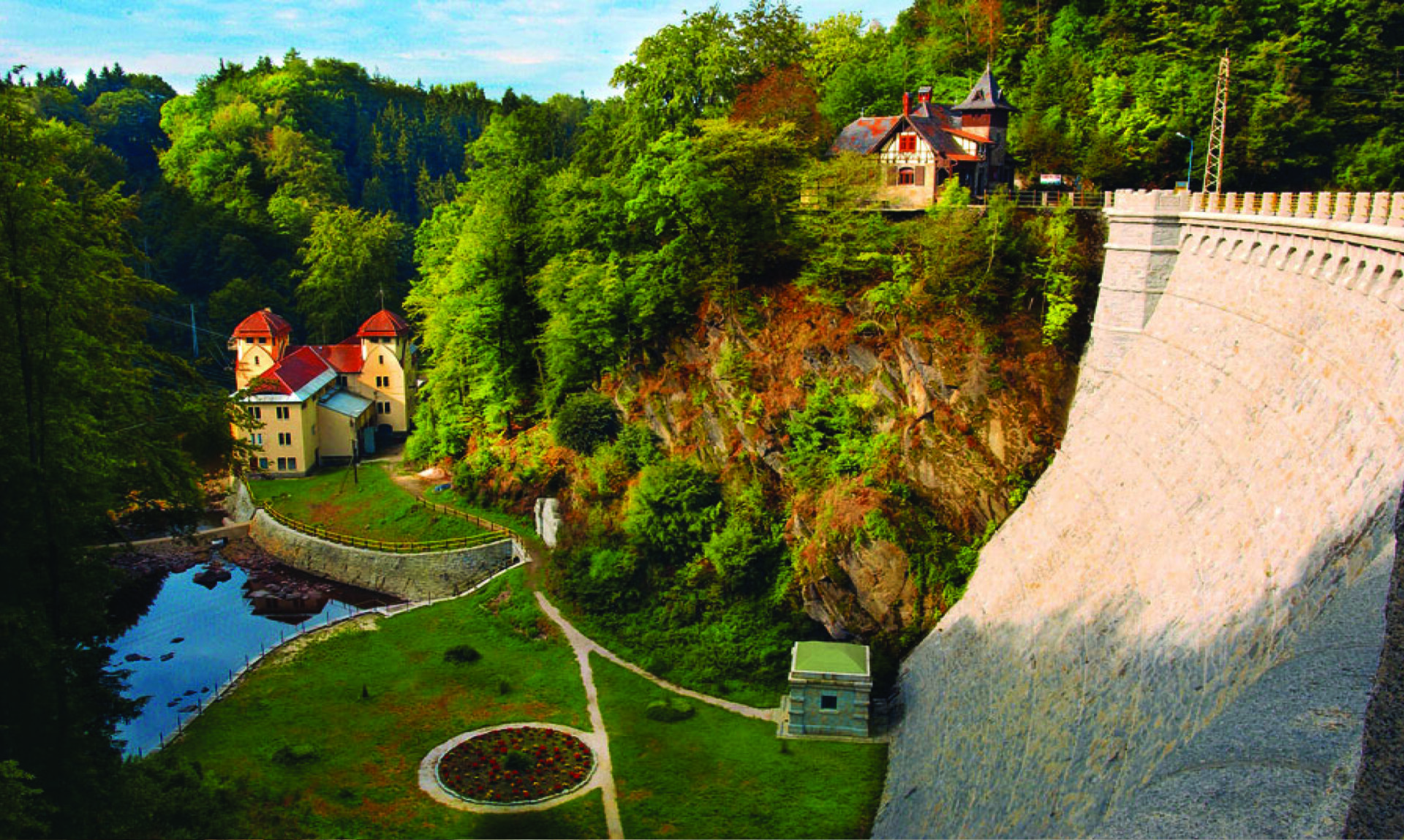
Returning to the main highway, turn left and after a while the entrance gate of Czocha Castle with a parking lot in front of the entrance appears to our eyes. The structure stands on a rocky promontory rising high above the waters of Lake Leśniański. This frontier stronghold was built in the mid-13th century, and construction began by order of Czech King Wenceslas II. The fortress, which was difficult to conquer, changed owners many times. Between 1451 and 1700 it was in the hands of the von Nostitz family. Historical sources state that the castle was deserted in the mid-19th century. It owes its present appearance to German entrepreneur Ernst Gütschow, who bought the castle in 1909. He commissioned architect Bodo Ebhardt to rebuild it, which was to restore its historic appearance from an early 18th century engraving. Until 1945, the estate was the apple of the Gütschow family's eye. It now houses a hotel and restaurant, and has a separate museum section, which can be visited under the guidance of a guide. Czocha Castle still hides many secrets, both from distant times and more contemporary ones. Hypotheses say that German ciphers were supposed to have worked there during World War II. Curiosity is also stimulated by the existence of secret passageways, of which only 13 have been found, while historical sources say there are 40. A beautiful panorama of the castle and the lake can be seen from the "Izery" Sailing Stop, which is a bit distant from the castle and is reached by a gravel road that bounces down from the asphalt one.
Those who have problems with free movement can park their car near the castle courtyard. Entry must be reported to security at the castle gate. Due to the historic nature of the building, only a small part of it is adapted for movement by people with limited mobility. The courtyard in front of the bridge leading to the castle is strewn with gravel, which can make it difficult to move around in a wheelchair. Before entering the castle there are three steps and a threshold in the doorway. On the right, just beyond the door, is the reception desk, where you can ask for help getting into the two rooms on the first floor - the Knights' Hall and the Marble Hall just beyond it. Access to the first of these halls is restricted by a single stone step. Unfortunately, there are no facilities for getting to the upper levels of the castle, making them inaccessible to everyone. Since the facility does not have a special permanent tour for people with mobility limitations, it is best to plan your visit in advance and contact the staff, who are very welcoming to visitors and sensitive to helping anyone who needs it. The viewpoint of the castle from the marina is rather difficult to access for people with mobility problems, as the best view is from a grassy meadow that is not accessible by a paved road.
Zlotnicka Dam
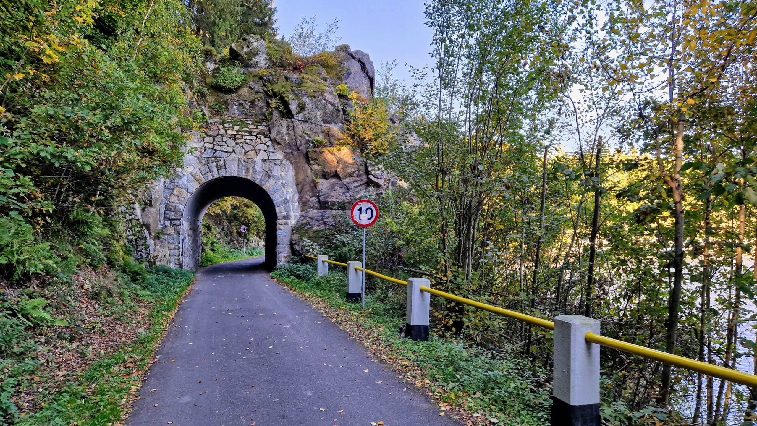
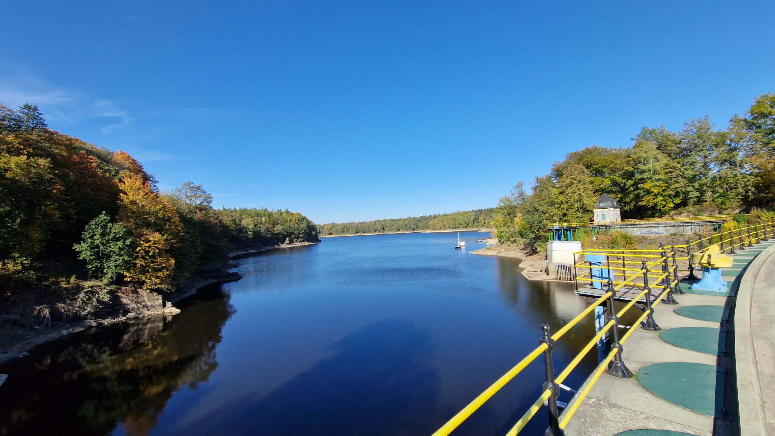
Continuing along the road toward Zlotniki Lubanskie, you can see another dam on the Kwisa River, thanks to which Zlotnickie Lake was created. Wanting to get there, you need to leave the main road, turning left at the signpost to the Golden Dream Hotel. Then, at the intersection, take the road to the right, which leads to a small parking lot. Unfortunately, recently the situation of this place has become very complicated. The hotel complex has been put up for sale, and the road to the dam from this side has been closed due to repairs to the tunnel carved into the rock that leads along the shore to the crown of the structure. It is to be hoped that the situation will quickly return to normal and this place will regain its former tourist value. The retained waters of the Kwisa River have formed Lake Zlotnickie, which looks like a Norwegian fjord. It is long and narrow, and its shores are surrounded by gentle slopes covered with forest. The dam is located in its western part. Its construction was completed in 1924, it is 36 meters high, its crown is 5 meters wide and 168 meters long. The whole has a footing of 27 m wide.
Lubomierz
After visiting Lake Zlotnickie, you need to return to the main road, turn left and head to Gryfow Slaski. Noteworthy there is a unique, the only Wagarowicz monument in Poland. On the column of the fountain standing in the shadow of the 300-year-old town hall you can see two bronze figures depicting playing schoolchildren. The fountain itself also has an interesting history, as it was built in 1908 to celebrate the opening of the town's waterworks. From Gryfow Slaski the route goes along Route 30 in the direction of Jelenia Gora, to turn left in Radoniów to Lubomierz. In this town, the attention is drawn to the historic town hall in the market square, rebuilt after a fire in the 19th century, and the former Benedictine convent with the Church of the Assumption of the Blessed Virgin Mary and St. Maternus can be seen in the background. Within the historic part of Lubomierz one can find quite a few interesting buildings, such as a pillory from 1530 and a Baroque fountain from 1717. The town served as the backdrop in the cult film "Sami swoi" and is now known as the capital of Polish comedy. The National Comedy Film Festival is held here every year. The city is also home to the Kargul and Pawlak Museum. The exhibition presents the life of displaced persons in the Recovered Territories just after World War II.
At the market square in Gryfow Slaski there are parking spaces with an envelope. The surface is flat and free of architectural barriers. The market is small and you can treat this place as an optional stop on your journey.
The surroundings of the Lubomierz town hall have been revitalized in recent years. The surface has been paved with cobblestones, and the market square itself is largely covered with rather uneven cobblestones that make it difficult to move around. The sidewalks around the market are free of obstructions and allow one to easily admire the architecture.
Wleń
From Lubomierz the route goes to the village of Plawna, where you need to turn right onto road No. 297. After a few kilometers you need to turn left off this road, heading for Wlen. The road leads through a very picturesque valley, and just before the town it descends sharply down to the bank of the Bóbr River. In Wleń it is essential to stop at the picturesque market square. It is dominated by the town hall from the 18th century, in front of which there is a statue of the Pigeon Woman erected in 1914 on the occasion of the 700th anniversary of the town. Outside the market square, St. Nicholas Church, dating back to the 13th century, is worth seeing. On the other side of the Beaver River stands the Baroque Ducal Palace, whose history dates back to the 16th century (now a hotel and restaurant).
The revitalized market has a good surface, free of architectural barriers. Several privileged parking spaces have been designated within its reach. Unfortunately, going outside the market, one encounters high curbs and uneven pavement quite quickly.
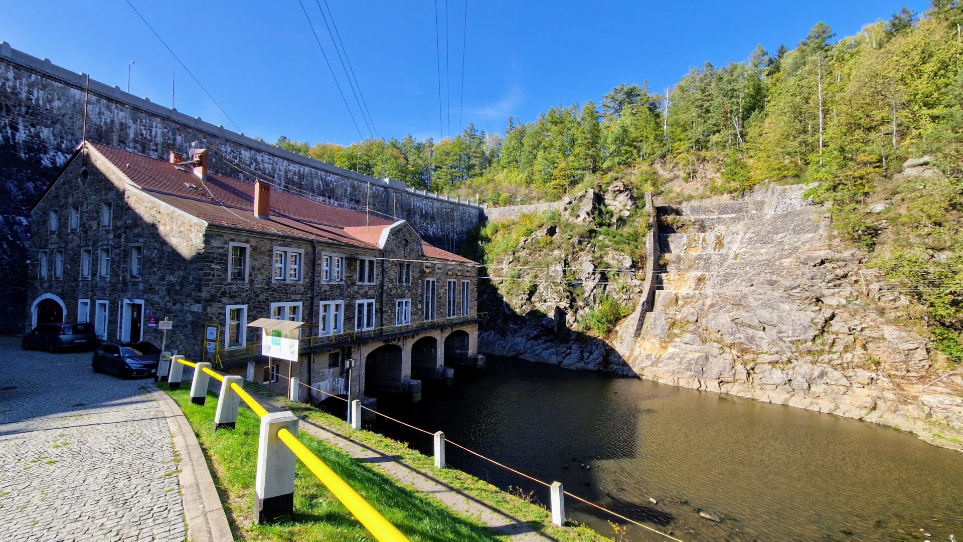
Pilchowice Dam
Staying in the valley of the Beaver River, the route goes up its course to the stone dam in Pilchowice. It rises 62 meters high and has a crown 290 meters long, curved into a slight arch 7.2 meters wide. Kaiser Wilhelm II himself attended its grand opening in 1912. It passed its first major test in 1915 during heavy rainfall. Despite some shortcomings, the flood was stemmed and the whole project could be considered a great success. It is the most beautiful of the Lower Silesian dams. The wall squeezed between the slopes of two mountains, Zamkowa and Korzec, looks impressive from all sides. The best point for observation is the wooden bridge over the Beaver River, which is perfectly visible from the crest. At the foot of the dam, at its 50-meter wide footing, there is a hydroelectric power plant building. The Pilchowice Dam is one of the few objects of this type in Poland, on the crown of which you can legally drive a car (limit 2.5 t and speed 10 km/h). Driving a little farther along the narrow road along the shore, one reaches a disused railroad station, as well as a bridge that in recent years has become the hero of a media storm due to the idea of blowing it up for an American action film. The bridge is a truly impressive structure. It was built in the early 20th century and for years served the railroad line from Jelenia Gora to Zagan. The structure is almost 152 meters long and 4 meters wide, and is supported by two pillars. After the creation of a reservoir on the Beaver River in 1912, trains began to pass over the water. Surrounded by gentle hills on Lake Pilchowice, the route comes to an end. Water, although not directly visible in many places, has shaped this corner of Lower Silesia and gives it a unique atmosphere. It was along the rivers that people settled for centuries, and used the valleys for important transportation routes. There is magic in the water, which is worth feeling up close. On this route you can see its various facets, the common denominator of which is natural beauty. Man has often put his hand to this nature, but not by destroying it, but by cooperating with it. This makes these places even more remarkable!
An unpaved parking lot for cars is located opposite the entrance to the dam's crown. The surface on the dam itself is flat and free of obstructions. On the lake side there are metal railings that do not restrict the view. A stone wall on the other side obscures the panorama quite a bit. Wanting to see the dam in all its glory, you can go by car to its foot, a wooden bridge over the Beaver River. Unfortunately, it is ondość narrow and has an uneven wooden surface. However, the traffic on it is negligible, so if someone had trouble getting around, with someone's help they can see this one of the largest stone dams in Poland from its level.